Length: 6.6 km
Difference in altitude: 250 mt
Travel time (hours): 1:55
Suitable for: Everyone
Trail description
Grezzana's library is the starting point of this trail that climbs up a forest ridge, until reaching the ancient La Colombara district, near Lumiago; from the library's parking lot, continue north, along Via Segni, until you reach Viale Europa. Here, turn right, toward Catena. On the bridge junction, keep the right and continue until reaching Sarmazzi. Once you reach the residential area, at the crossroad, on the left you'll find the long CAI trail, with its amazing and impervious Vaio Paradiso.
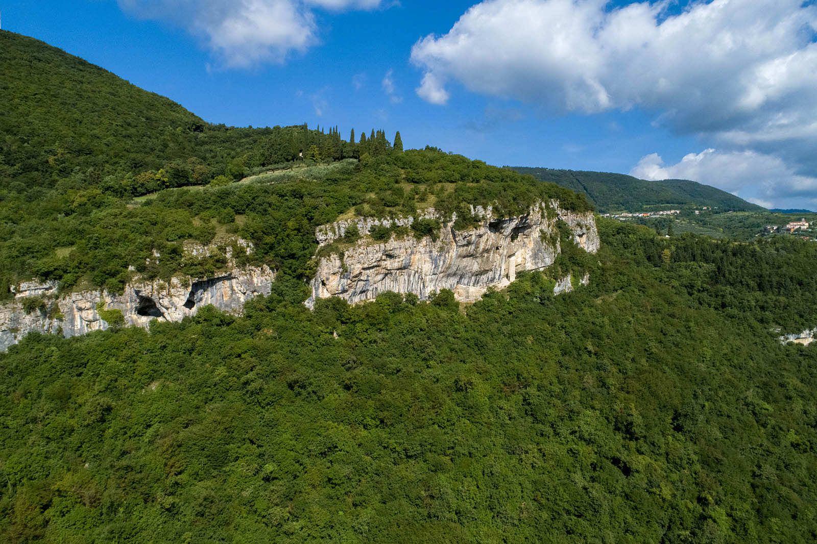
Our trail continues straight, starting the gradual climb up the dense forest, until you reach Bonizzola. On the crossroad of the first district, take the left, to run along the vineyards, and get back into the woods, until you pass the watershed of a small vaio, and get out onto a scenic olive grove; this stretch ends on the ridge, where you will find a well-marked mule track which, climbing up on the right, gets out of the woods, and back on the vineyards, up to La Colombara. From this ancient district, the panoramic view overlooks the lower Valpantena, Monte Comun's ridge, the upper western Lessinia, and, far away, the peaks of Monte Baldo. La Colombara. Da questa antica località la vista panoramica si staglia verso la bassa Valpantena, la dorsale del monte Comun, l’alta Lessinia occidentale e, in lontananza, le vette baldensi.
To get back, take the ridge back into the woods, until you reach a junction. Leave the mule track, keep the right to get down on a winding trail that goes back into the nearby fields, near Sarmazzi. If you are careful not to step on the crops, you can cross this small track to get back on the outward trail; from here, you can get back to Catena and to Grezzana's library.
Stages of the trail:: Grezzana Library (175m) - Catena (190m) - Sarmazzi (206m) - Bonizzola junction (289m) - dorsal junction (370m) - La Colombara (435m) - dorsal junction (370m) - Sarmazzi (206m) - Catena (190m) - Library of Grezzana (175m).
Warning: in order to use the map of the GPX file you need an external application downloadable from PlayStore or AppStore.


Follow Feet's signs
All trails are marked by signposts, trail poles indicating the path (sometimes with information stands) and message boards.
Orange indications refer to hiking trails, while light blue ones to biking trails.


Project financed in part with the contribution of Bim Adige
© FEET Comune di Grezzana. Tutti i diritti sono riservati | Privacy Policy | Cookie Policy
The textual and video-photographic materials are owned by the Municipality of Grezzana. Even partial reproduction is forbidden without prior authorization.